 Chris Stapleton is a soil scientist and member of the RTPI. He has used soil information within the planning system for more than four decades. He has specialised in soil and Agricultural Land Classification surveys, the management Environmental Impact Assessments, Sustainability Appraisals and Habitats Regulations Assessments. His final full-time role was with HS2 Ltd as route-wide lead in assessing impacts on land and soils, and he is now semi-retired.
This is the first of two articles originally published on Linkedin and subsequently adapted for the RTPI blog in response to the recent International Day for Biological Diversity and in recognition of the biodiversity within soils.
Soils are a finite resource that form at different rates in different parent materials over very long periods of time, but they can be lost almost instantly because of development. Therefore, soils displaced by development, both temporarily and permanently, should be conserved. Good practice in soil handling methods and the use of suitable machinery in dry conditions, as set out in the Defra (2009) “Construction Code of Practice for the Sustainable Use of Soils on Construction Sites” (currently being revised) will avoid the compaction and destruction of soil structures and help to achieve successful land restoration and habitat creation/translocation.
In general terms, the Defra document is technically sound. The problem is that this guidance is not sufficiently applied in practice by site operators and contractors, and standards of soil handling and land restoration are not adequately monitored or enforced.
Part III of the recently published IEMA guidelines on land and soils in EIA (see below) addresses this and sets out ideas on how to fill several skills, comprehension and procedural gaps for the more effective implementation of the revised Defra Code of Practice, when it is published.
Understanding the issue
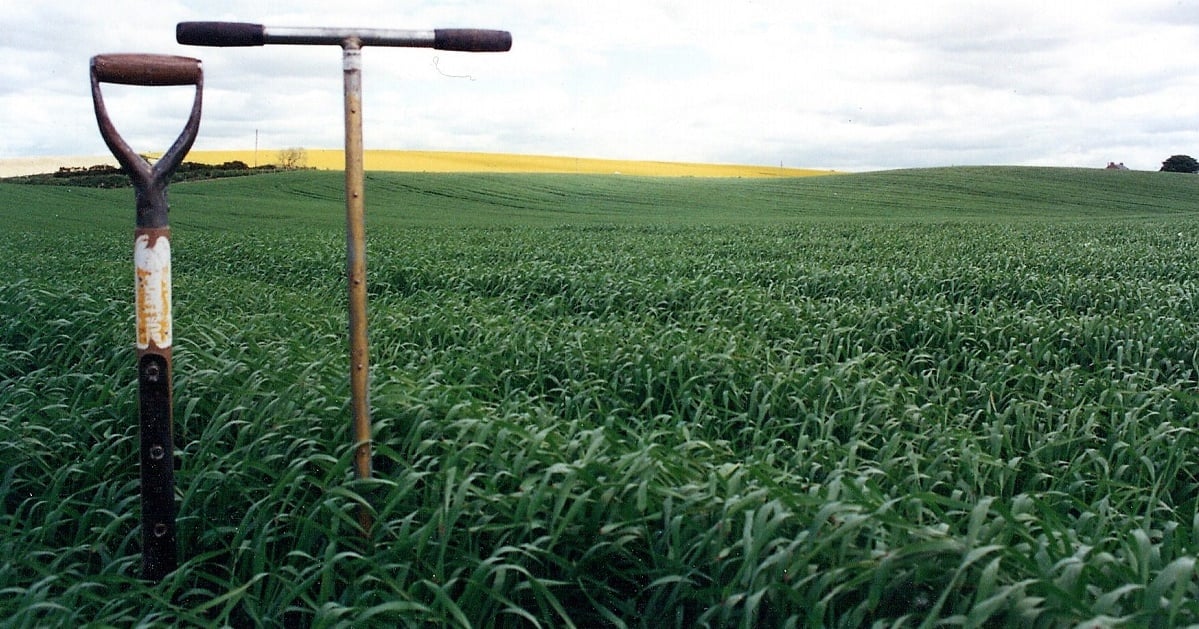
We can’t see soils, so we carry out a survey with an auger and a spade
To understand the importance of soil conservation you need to understand some soil basics. Soils are a Cinderella subject when compared with the emphasis given to other subjects like ecology and landscape, for instance. I think this is because for most people soils are unknowable in the sense that you can’t see them unless you catch a glimpse of topsoils when agricultural land is being ploughed. Also, finding out about soils involves specialist field survey using a combination of soil auger cores and soil profile pits to describe soil characteristics and to determine the different soil types within a study area.
Unfortunately, the language of soil specialists can also be too academic for effective communication. My approach is to keep it simple and avoid esoteric terminology, so perhaps I can demystify the subject and make soils a little more knowable.
A soil profile is a vertical cross section through a soil showing the topsoil and subsoil, both of which are required for a soil to function and provide a range of ecosystem services, such as food and other biomass production, flood water attenuation and carbon storage. In fact, many ecosystem services are derived from soils.
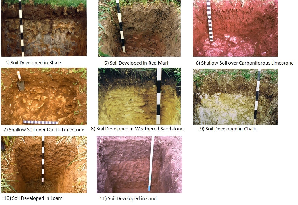
Soil characteristics reflect the climate, soil organisms, topography, and underlying rocks (parent materials) in a given location. Soil types can vary across relatively small distances, with different soils having different capabilities. On soft parent materials like clays, soils can extend to depths of 1.2m or more, and remarkably (given how long they have been developing) on hard parent materials like Carboniferous Limestone, they can consist of nothing more than about 20 to 30cm of topsoil, where their functions are limited in the absence of a subsoil.
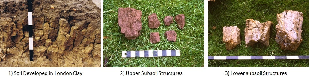
The first photo below illustrates some soil basics. In most soils (other than peat) the organic matter and carbon is concentrated in the dark brown topsoil which lies above a lighter coloured subsoil developed (in this example) in London Clay. Subsoils reflect the nature of the parent materials, and they are important because they have porous structures that provide drainage channels supplying the oxygen necessary for root respiration and the uptake of nutrients. These subsoil properties support plants that start to grow in the topsoils, before extending their roots down the drainage channels and into the porous structures below. Note the well-defined subsoil structures in the first photo, and the largely vertical drainage channels between them.
During my career, I have carried out soil and Agricultural Land Classification surveys throughout the UK and dug soil pits in many different soil types. I have selected some photographs to illustrate how soils reflect the nature of the parent materials within which they have developed, and these are shown below.
I hope that you have enjoyed this insight into soils and find them more knowable. All photos in this article are my own, and they are free for you to use. Please attribute them to “Chris Stapleton”.
Fixing the problem
For development control purposes, planning applications should be validated by detailed site-specific soil surveys carried out at a scale of 1:10,000 or larger (and a density of auger sampling of at least one per hectare), providing information on the basic properties of soils within a development site, such as soil profile textures and structures, together with an inventory of topsoil and subsoil volumes. This information is required to adequately inform planning conditions on soil conservation at the pre-construction phase, preferably within a Soil Management Plan/CEMP. The necessary soil information is largely available from the results of ALC/LCA surveys, which are already embedded in the development control process in respect of the conversion of agricultural land to various forms of hard development. This is the land use change that leads to the greatest loss of and potential damage to the soil resource. Urban soils not covered by the development control requirement for ALC/LCA surveys will require separate soil surveys, possibly as part of a contaminated land investigation.
In particular, the treatment of soils permanently displaced from a red line site by hard development needs to be more fully addressed to facilitate their sustainable reuse off-site, whilst complying with “waste” controls.
Matching soil types to soft (i.e. green) land uses
When considering the use or reuse of soils incorporated within or displaced by development, different soil types should be matched with the intended soft land uses, and this should be considered within a Soil Management Plan/CEMP.
For example, heavier clayey and silty soils form a suitable substrate for the establishment of wetlands, local adjustments to topography and hydrology, and introducing ground cover that promotes carbon sequestration. Lighter sandy soils are suitable for biodiversity associated with low nutrient grassland and heathland. Loamy soils are likely to be derived from more intensively used agricultural land and tend to have relatively high retained nutrient levels, and they are better suited to continued biomass production. It is in this appropriate use of available soil resources that developments can secure lasting net biodiversity gains.
New guidelines
As a result of my experience, and what I consider to be the current unsatisfactory protection of soil functions within the planning system I was asked to lead on the production of new IEMA guidelines for the assessment of development impacts on land and soil within the EIA process. The guidelines were published in February 2022, thus raising the profile (pun intended) of soils, just as Cinderella did meet her prince…. eventually.
The guidelines provide more advice on how soil functions, soil health and terrestrial ecosystem services can be embedded into EIA practice.
Find out more:
You can read a more detailed account of some important soil properties relevant to land use planning and soil conservation in the accompanying pdf. This is illustrated with more photos taken during my field survey work. It is an adaptation of my second Linkedin article and makes connections between soil properties, soil functions, soil health, soil displacement and good practice in soil handling for land restoration.


